








 Back
randonnee
Etangs des Combrailles
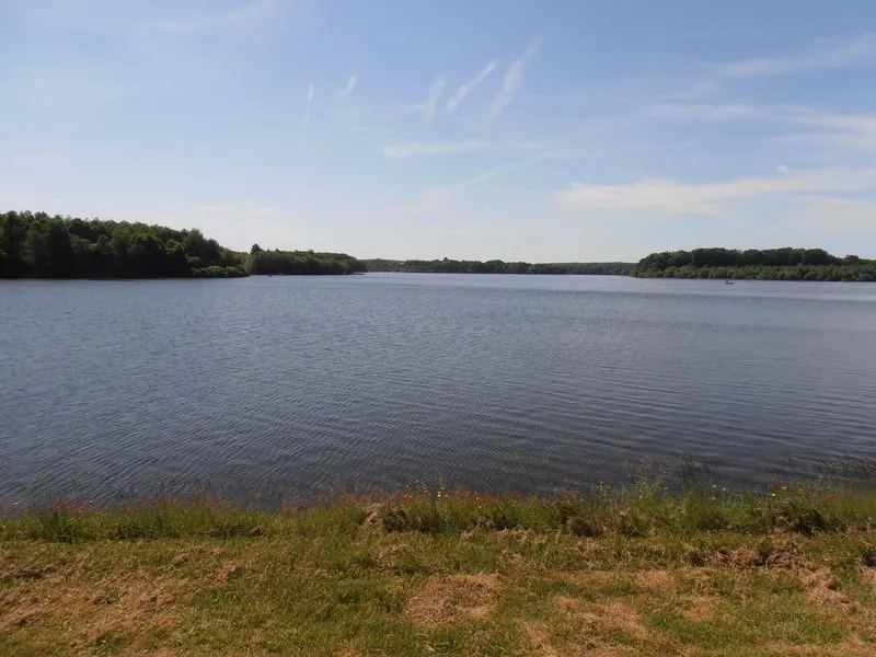
The "Etangs des Combrailles" loop consists of 3 stages:
- Charensat (place de l'église) / Montel-de-Gelat: 18.5 km - 5h30
- Montel-de-Gelat (church square) / Dontreix : 11.5 km - 3h15
- Dontreix / Charensat: 11 km - 3h00
Description
Start stage 1: From the start sign, go down the D13. Turn left towards La Raterie. After about 1 km, take a right-hand track. At Sourdoux, turn left down the road. Turn left at the fork. At the T-junction, go right, then straight ahead on the main road. Ignore the first crossroads, then take a left-hand path for 100 m through the woods; turn right (educational path), then right again to reach a forest roundabout. Turn right, skirting the campsite, and join the D60, which you take on the right. After 300 m (at a stadium), take the first left to La Gorce, then left again to the Chancelade pond. Go around the pond to the left and follow the small road to the D13.
1 - Turn right. As you climb the hill, take a wide track on the left. Go straight ahead to a fork at the edge of the wood. Turn right and keep right at the next fork. At the third fork, turn left onto a small road. Turn left, then immediately right onto a track. Stay on this track until you reach the D13, which you take on the left for 50 m. Turn left (towards étang du COS du SDIS) and keep left at the fork. Go straight on until you reach a crossroads.
2 - Turn right and go straight on, ignoring the paths on either side. At the T-junction, turn right, then left towards the Bouesse pond. Go around it to the left, then up the path through the woods. Keep to the right and continue along this wide track until you reach a
intersection. Go left. At the fork in the road, keep left and continue to the entrance to the hamlet of La Ribière.
3 - Take the road to the right and turn right at the first crossroads. Follow the wide track to the D13. Turn left and immediately take the first right. At the road, turn right. At the fork, turn left into the hamlet of Longueville. After the cross, go left down to the road. At Montel, turn left into rue des Ecoles and, at the fork, left into rue de l'Etang Neuf. Pass under the church, then turn right to reach the Monument aux Morts.
Start stage 2: From the start sign, in front of the war memorial, turn left around the church, then immediately left (rue sous le château). After 100 m, take the first track on the right, leaving a track on the left, then turn right to reach a road. Turn left to Les Bourrans. At the crossroads, turn right, then right again as far as
l'Etang Neuf.
1 - Follow the tarmac road to the left, skirting the pond (part shared with several PR trails), then follow the road to Les Corrioux Hauts. At the crossroads, take the track on the right. After 200 m, leave a track on the left and continue to the tarmac road. Take the track opposite. After about 150 m, turn left at the fork in the road and continue as far as the hamlet of Les Chazeaux, ignoring the paths to the left and right. At the first house, turn left through the hamlet of Les Chazeaux. At the road, turn left to reach La Marzelle. Turn right twice. At the end of the village, turn left on a downhill track and continue on the main
to a wooden cross.
2 - Take the right-hand path down to Hauteserre, ignoring the side paths. At the crossroads (school bus stop), take the left-hand path to the cross; pass to the right of the cross and go down to a pond. Take the road to the right as far as the entrance to Dontreix, cross the D4 and continue straight ahead as far as the Place de la Mairie.
Start stage 3: From the start sign, climb up towards the church. Turn right onto route de Malganne. After 50 m, go straight on, ignoring two streets on the left. Pass the Ste Anne cross. At the last house, the road is extended by a path. At the first fork, turn right. At the next fork, in the Drouille forest, turn left to reach the road.
1 - Follow the road to the left. After 500 m, turn right onto a track for 50 m. At the fork in the road, turn right until you reach an intersection with a wide forest track. Turn left onto this track. At the black cross, go straight on to the next fork.
2 - Fork left to a T-junction. Go left to Les Mouneyroux. At the intersection at the entrance to the village, turn left for 50 m, then right. Pass the Mouneyroux château. At the next fork, turn left towards Le Moulin des Mouneyroux. Continue straight
to a T-junction.
3 - Go left up to a fork. Turn right. At the crossroads, turn right onto a grassy path to Troissagnes, ignoring the side paths. Take the road to the right. Follow the road up into the village and continue to the top of the hill.
4 - Take a right-hand path for 400 m. At the intersection, turn left and continue straight on to Charensat. Continue past the retirement home to Place de l'Église.
Prices
Free access.
Itinerary
-
 Distance
41km
-
 Kind of route
Loop
-
 Elevation gain
555m
-
 Roaming duration
3 jours
-
 Marked route
Yes
-
 Precision Marking
Green and white
Opening period
All year round daily.
Location
Pets
Pets allowed : Yes
Dogs must be kept on a leash due to the presence of herds.


-
Distance
41km
-
Roaming duration
3 jours
-
Elevation gain
555m
-
Kind of route
Loop